Among its many applications, GPS technology helps surveyors establish property lines and boundaries. Compared to conventional surveying methods, GPS land surveying produces accurate results with little effort, and also provides greater flexibility and improved efficiency than older surveying tools. However, despite its many benefits, GPS surveying does have its share of disadvantages.
Interference
Video of the Day
GPS surveying relies on receiving information from satellite signals. If anything interferes with signal reception, the GPS results can lose accuracy. Tree coverage, building and other tall structures, whether natural or manmade, may block satellite signals from reaching the GPS receiver. Electromagnetic interference and even radio signal interference may also disrupt GPS accuracy. Satellite signal reception also means that GPS cannot be used when surveying underground areas or any property blocked from a direct view of the sky.
Video of the Day
Positioning
A satellite constellation is a group of satellites working together to provide signal coverage for a designated area. Any change in the satellite constellation's positioning may affect GPS accuracy. Because satellite positioning is usually best during the normal 9-to-5 workday, taking GPS surveying data outside of these peak hours may compromise results. Such time constraints can lead to scheduling difficulties.
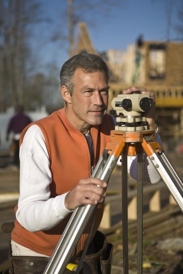
Antennas
Conventional surveying produces data that can be divided into horizontal and vertical measures, while GPS surveying delivers a fully three-dimensional representation, making it impossible to separate the horizontal from the vertical. In GPS surveying, changing the horizontal measure changes the vertical and vice versa. Fixed-height antennas can help alleviate the problem, eliminating the need for height adjustments at each new location. However, errors in measuring antenna heights can plague many GPS surveys.
Elevation
Measuring elevation, or a point's height above a gravity surface, is the most significant flaw in GPS surveying. GPS is incapable of directly measuring differences in elevation. Surveyors must instead use an accurate geoid model, which depicts the shape of the world's oceans under gravity alone, and at least four established benchmarks to determine a point's elevation. The added effort may prove frustrating and time-consuming for many. In addition, errors in antenna height, baseline measurements and control point locations can further undermine elevation accuracy.