• Around The HomeToggle Menu

    • Entertainment
    • Productivity
    • Smart Home
  • FamilyToggle Menu

    • Parenting
    • Toys
    • Pets
    • Travel
  • Product ReviewsToggle Menu

    • Phones
    • Tablets
    • Laptops
    • Desktops
    • Wearables
    • Audio
    • Cameras
    • Headphones
    • Printers
    • Smart Home
    • TVs
    • Gaming and Video
  • One Cool ThingToggle Menu

    • Frugal Tech
    • Kickstarters
    • Videos
Techwalla
  1. Home
  2. Around The Home
  3. Productivity
  4. What do the Road Colors in Google Maps Mean?

What do the Road Colors in Google Maps Mean?

March 31, 2015
By: MelanieC
  • Share
  • Share on Facebook

Google Maps employs several road color options to allow users to quickly navigate roads and plan their trip in the Google Maps application. The colors indicate types of roads and also how fast vehicles are traveling on those roads.

Video of the Day

...
Map View of Google Maps

Map View

...
An iPhone view of Map View Colors: Orange (Interstates), Yellow (State Highways), and White (Local Roads)

In Map View, orange, yellow, and white differentiate types of roads. Orange indicates interstate highways. Yellow indicates state highways and county parkways. White indicates local and private streets.

Map View Drawbacks

Colorblind users and black-and-white printers cannot distinguish orange, yellow and white.

Satellite View

...
A Satellite View on Google Maps shows the terrain from a bird's eye, satellite view.

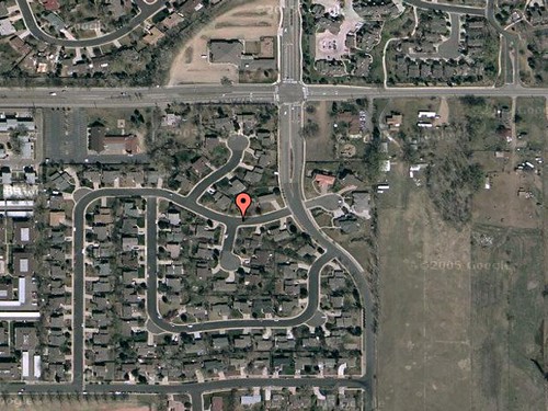
Satellite View has no color overlay. To view colors, put your mouse over the Satellite View button and click the "Show Labels" checkbox.

Traffic View

...
A Traffic View of Google Maps. The green overlay road indicates cars are traveling above 50 mph.

Traffic View allows users to check for delays. This color scheme indicates the average speed of vehicles traveling on those roads at that time. When active, the Traffic View color key appears in the upper right-hand corner. Green indicates vehicles traveling more than 50 miles per hour. Yellow indicates speeds between 25 and 50 mph. Red means speeds are less than 25 mph. Gray means there is no data available. Black and red roads indicate traffic may be stopped at points. A yellow construction triangle means construction is causing delays.

Traffic View Drawbacks

Many state and local roads will not have Traffic View information. These roads may have delays, but Google Maps will not report them.

Show Comments

Related Articles

How Do I Print the Google Street View Picture?

How Do I Print the Google Street View Picture?

Around The Home
Productivity
By: Julian Vargas
How Does a GPS Car Navigation System Work?

How Does a GPS Car Navigation System Work?

Around The Home
Productivity
By: Kirk Brown
Choosing a New Wireless Plan the Smart Way

Choosing a New Wireless Plan the Smart Way

Around The Home
Entertainment
By: Jackie Dove
How to Unlock a NAVTEQ SD Card

How to Unlock a NAVTEQ SD Card

Around The Home
Productivity
By: Melissa King
How to Update a Magellan 1200 GPS

How to Update a Magellan 1200 GPS

Around The Home
Productivity
By: Melissa King
How to Download Maps for a Becker GPS

How to Download Maps for a Becker GPS

Around The Home
Productivity
By: Si Kingston
  • HOW WE SCORE
  • ABOUT US
  • CONTACT US
  • TERMS
  • PRIVACY POLICY
  • COPYRIGHT POLICY
  • Advertise

An error occurred. Try again later.

Thanks for signing up!
© 2018 Leaf Group Ltd. Leaf Group Media

Get great tech advice delivered to your inbox.

Keep your family productive, connected, entertained, and safe.

Please enter a valid email.